Wednesday, May 24, 2017

Portland Oregon area

Columbia River from Women's
Forum Overlook
 As we moved our way north our next stop was a week just east of Portland Oregon on the Historic Columbia River Highway - US 30. We spent a good part of two different days along the Columbia River Gorge. The first one was on the Historic Columbia River Highway which is certainly not a highway by today's standards. It is a narrow two lane road winding along the cliff of the river with the purpose of giving views of the river gorge and numerous water falls. We stopped at vistas and many water falls to fill a wonderful day.
View looking across river from
Women's Forum Overlook


The second day spent along the river was much faster paced. We drove east on I-84 which hugs the river. We enjoyed the scenery at the few view points that are available, the town of Cascade Locks, and the Bradford Island Visitor Center which is at the Bonneville Lock and Dam. This visitor center has exhibits related to the locks and dam as well has some history of the Columbia River. It also has viewing windows into the fish ladder so you can see fish swimming by. The top of the fish ladder funnels down to a scant 18 inches wide and goes by a window so the fish can be counted.

Bonneville Hydroelectric Dam
 Yes, someone sits there and counts fish (24/7) and tracks them by species. We had a very good lunch in Hood River, a really neat little town, at the Full Sail Brewpub that has a great view of the river. We drove a few miles south from Hood River on US 35 to the Panorama Viewpoint to get a spectacular view of Mount Hood. We drove another 10 miles or so east on I-84 until we got a good feel for how the terrain opens up and becomes more arid. At this point we decided to turn around and head back.
Fish going through counting tunnel

Fort Vancouver
Another day was spent driving to Vancouver, Washington, across the river from Portland, to go to Fort Vancouver National Historic Site. This is a reproduction of the Columbia Department headquarters of the Hudson's Bay Company built around 1825. For two decades the fort was the center of fur trade for the Pacific northwest. After America gained control of the land, the company continued to operate the fort but trade slowly diminished until they moved out in 1860. After abandonment the structures were destroyed by fires and decay in 1866. Paintings, written accounts and archaeological work gave the information necessary to create an accurate recreation of buildings and activities within and around the fort.
End of the Oregon Trail site

We took the long route home from Fort Vancouver to go to the "End of the Oregon Trail" on the south side of Portland. We got there late so we didn't have time to tour the inside exhibits but we walked around the grounds and read the interpretive signs, which ultimately, told us what we wanted to know.

Bridal Veil Falls

Multnomah Falls

Columbia River Gorge along I-84

Mount Hood from Panorama Viewpoint

Fort Vancouver outside

Fort Vancouver

Fort Vancouver
End of the Oregon Trail plaque

Monday, May 15, 2017

Newberry National Volcanic Monument

We visited the Lava Lands Visitor Center at Newberry National Volcanic Monument to see what it was all about and ended up spending about three hours, it was amazing. We learned a lot about the
Looking down in volcanic code on
Lava Butte
volcanic history of the Cascade Mountains in Oregon through the exhibits in the visitor center plus we drove to the top of a volcanic cinder cone (Lava Butte) and then walked the Trail of the Molten Land at the base of Lava Butte. There were a lot of informative interpretive signs and we, once again, timed it for beautiful weather so we could see a lot of volcanic cones and mountains for probably 100 miles in every direction.

This is not a National Park Service location, but rather, is run by the Forest Service as part of the Deschutes National Forest. The monument is very large and includes the Newberry Caldera with lakes and a lot of hiking. Once gain, this time of year (mid-May) there is very little open due to snow closures. Here I am again adding to the list of places to return to in the fall.

View from top of Lava Butte - dark
color down below is huge lava flow

Trail of the Molten Land

Trail of the Molten Land

Trail of the Molten Land

Crater Lake National Park

As we moved north through California, we had planned on going to Lassen Volcanic National Park but we discovered that most of the park was still closed with snow. Rather than just going to the
Sundial Bridge - Redding CA
 visitor center we opted to have a day of leisure and see what was in Redding. We opted for a river walk that included seeing the Sundial Bridge. It was a pleasant day topped off by seeing a Bald Eagle nest complete with an adult Eagle sitting on it.

The next day we headed north to Fort Klamath Oregon to be as close as possible to Crater Lake National Park. The weather forecast wasn't good with rain and accumulating snow over the next five days other than a potential break late the day we arrived or early the next. We decided that we would see if we could get lucky with this little break in weather and then leave before another layer of snow. By the way, this was Mother's Day weekend. We had rain when we arrived and they had snow up in the park (2500 feet higher) so our window was down to the next morning.
Snow gets deeper and the roads
get slicker as we enter Crater Lake NP

We got up early to clear skies so we quickly went into the park before the clouds moved in. We were rewarded with a spectacular winter scene and amazing pictures of the lake. Needless to say we couldn't do much with 15-20 feet (maybe more) of snow on the ground but at least we weren't shut out. We learned that at least 50 percent of the time, this time of year, you can't even see the lake so we were blessed. The average snow fall here is 44 feet so I don't know how deep the snow was I was standing on for the pictures but fortunately it was hard packed by previous people. It was cloudy within two hours. Our list of things to come back to in the fall is growing.


Crater Lake
Rim Village Visitor Center was
closed for some reason
Crater Lake

Crater Lake
Snow at Steel Visitor Center isn't
quite as deep down a little off the rim.
They had this one open.

Saturday, May 6, 2017

Yosemite National Park

During our seven years of full-timing there have been numerous times that people have said "surely you've been to Yosemite" and I would have to reply "no, it hasn't fit into our meandering yet".
Yosemite Valley from Tunnel Viewpoint
 Well, it has now. I wanted to go in the spring when the falls would be flowing and not only did that work out, but they are flowing in record fashion after a much higher than normal snow pack at high elevations. Not only are the big name falls gushing but there are falls this year that park Rangers said they've never seen flow before. Plus we had two days of glorious weather to view it all. We got lucky indeed. All of this extra water had the Merced River above flood stage while we were there but fortunately not to the level that it hindered visitors.

Upper Yosemite Fall across flooded
meadow
 Yosemite National Park is huge (1,200 square miles) but the 5.2 million visitors that arrive each year primarily go to Yosemite Valley. It is the location for the incredible falls and world famous climbing cliffs. There is also high elevation Glacier Point that is normally well visited but the downside of us coming this time of year is the road was still closed due to snow. Plus, Mariposa Grove is closed for restoration until the fall of 2017. We will come back in the fall some year and do those high elevation sights. If those areas were open we would have needed another day.

We stayed at an RV park in Oakhurst which gave us a drive between 1.5 and 2 hours, depending on
Yosemite Falls
 how we hit traffic stops for logging along the road, to/from the valley. We went into the park really early both days to get a parking spot and not have a line at the entrance station. We did the Valley Floor Tour our first morning in the park and that was a great decision. The tour is in an open air tram so you get to sit and enjoy the unobstructed view, leave the driving to someone else, and listen to a Park Ranger give you a ton of great information. It stops for pictures and talks at key locations. Money well spent.

This park is as beautiful as everyone says and we are glad we finally made it. We don't view RVing, or life in general, as a race so we weren't in a hurry to get here. It was worth the wait.


View of Valley from pull-out
El Capitan

Half Dome

Mirror Lake

Illilouette Fall


Tuesday, May 2, 2017

Kings Canyon & Sequoia National Parks

Giant Sequoia right at
parking lot in Kings
Canyon Grant Grove
These two national parks, Kings Canyon and Sequoia, and Sequoia National Forest and Giant Sequoia National Monument are all adjacent so you drive back and forth from one to the other. You either enter from the south into Sequoia NP first, or from the west into Kings Canyon NP first. We entered from the west. You do a lot of driving up and down mountains between major sites.

General Grant Tree
Kings Canyon NP
40 ft diameter
This is the land of the Giant Sequoia trees. You know the old saying "the pictures don't do it justice"? Well, you have a hard time getting these in a picture. I used max wide angle or panorama but then the
picture is somewhat distorted. Make sure you take the time to get quality mental pictures, they are the best kind anyway.

There is a hike to Big Stump Basin where you can see stumps from the logging era in the 1880s before it was stopped. Actually standing on the Mark Twain stump helps give a perspective of the size of a Giant Sequoia.

Mark Twain stump in Kings Canyon
Big Stump Trail
The visitor center at Grant Grove Village has a great exhibit showing a cross section of a Sequoia tree with growth rings and fire damage marks going back hundreds of years. These trees are so big because they are amazing at withstanding fires, insects and drought in their lifetimes and thus they have hundreds and thousands of years to grow.

Drive to Kings Canyon North Unit
The Sequoias aren't the only sights here, being in the Sierra Nevada mountains the scenery in general is fantastic. Kings Canyon National Park has two units, south and north. To get to the north unit you "have the privilege" of driving across the Sequoia National Forest. This drive goes down and up the Kings Canyon following the Kings River. A spectacular drive that dead ends where you get to turn around and go back the other way and see it at the opposite angle.

Kings Canyon
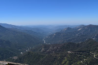
Sequoia National Park is just to the south of Kings Canyon. Other than the Giant Sequoia trees, the highlight for us there was the view from Moro Rock. Climb to the top of it and get a spectacular 360 degree view of the Sierra Nevada Mountains and Sequoia NP. 

Zumwalt Meadow - Kings Canyon
These parks are very large and you can only see a very small part from your car. There is much more accessibility via hiking. I'll be back to take advantage of that. Being here May 1 was too early. Most roads, trails, visitor centers, etc. aren't open yet. This trip was a great time to see the "highlights" at low crowd level. We got lucky and got here the day the road to the north unit of Kings Canyon NP opened. Check the website before coming to be sure what you want to see is open.


General Sherman Tree in center
Sequoia National Park

View from Moro Rock - Sequoia
National Park

View from Moro Rock