Sunday, June 23, 2013

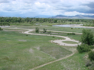
Headwaters of the Missouri River

Headwaters of the Missouri River -
Madison River on left merges with
Jefferson River on right to form the
Missouri
We decided to do something other than Yellowstone this weekend. Those that have followed our journey over the last few years may remember that we were in Montana two years ago when we went to Glacier National Park and did a lot of exploring in northwestern Montana. We were on the Missouri River in Fort Benton for a while where we explored and learned about the travels and discoveries of the Lewis and Clark Expedition in Montana. We didn't get much further south than the Great Falls area on that trip even though we really wanted to see the headwaters of the Missouri which was a primary objective of that expedition. It was just too far off our planned trip at the time.

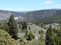
Headwaters from a  higher viewpoint
 On this year's trip to Montana we are at the southern tip of Montana so now we are way south of some of the things we want to see. On Saturday we drove about 100 miles north to Three Forks Montana to see the headwaters of the Missouri River. This gave us a fulfillment both in meeting a goal from two years prior but also it was satisfying in that we used to live in St. Charles MO where the river completes it's journey and joins the mighty Mississippi. We've now seen both ends of the great river (including witnessing the huge floods of 1993 when we lived there).
Gallatin River - it joins in a mile
downstream in distance

The official headwaters is where the Madison and Jefferson Rivers join together and about a half mile downstream the Gallatin River also joins. All three of these rivers are fairly good size which gets the Missouri off to a substantial start from it's very beginning. Over the last month we have become familiar with the Madison and Gallatin Rivers because they both start from within Yellowstone at or near the Continental Divide and roads run along them for miles. It was interesting to learn that the end of those formed the Missouri. Seeing the size of both the Madison and Jefferson Rivers I immediately wondered why Lewis and Clark gave them new names rather than just saying one of them was the Missouri (probably the Jefferson because it heads more westerly which was their objective). It appears that question was debated by them and they decided to go with this being the start of the Missouri so they gave new names to the rivers they found. I had always imagined a small stream slowly growing larger and larger to form the Missouri River but that is not the case unless we consider the origins of the Madison and Jefferson Rivers. Here is a link to the Wikipedia write-up for this state park. It references the debate.
http://en.wikipedia.org/wiki/Missouri_Headwaters_State_Park

Remains of Gallatin City - hotel
on left
The entire area is part of Missouri Headwaters State Park. A little bonus to the state park was a few remaining buildings of a ghost town from the 1860's. The city was abandoned when the railroad bypassed it, a story shared with a lot of other towns.

Bonus picture for today. We saw some beautiful Cedar Waxwings while walking around the state park.
Cedar Waxwing

For the fun of it, below is a picture of the Madison River in Yellowstone National Park about one mile straight east of the town of West Yellowstone. It is not very deep here but it is quite wide. Elevation here is about 6600 feet versus around 4000 feet when it flows into the Missouri.
Madison River in Yellowstone
National Park

Links to more info

I'm finally getting around to posting a link to a map and explanation of The Grand Loop in Yellowstone National Park. This may help those that have been following along as I've described different sections of the park. The grand loop is a figure 8 of roads with fingers going to each of 5 entrances. I've been meaning to find something like this and post it for a while and am finally getting around to it.

Here are two links.  The first is the official Yellowstone National Park website and you can cruise around to all the other links for more information on things that I've mentioned over the last month. 


Tuesday, June 18, 2013

Northern Yellowstone

View from Dunraven Pass
Yellowstone Lake fogged in
Grand Tetons in the far distance
Fresh coat of snow on Dunraven Pass
We got up to a cold (32 degrees), foggy morning last Saturday. The forecast was for a great day so we headed into the park with confidence that the fog would burn off. We were headed to the northeast section of the park so we knew we had at least an hour drive (depending on buffalo slowdown time) and we were headed to higher elevation so it would be even colder and thus probably no fog. We entered the west gate about 7:15 and by the time we pulled into Canyon Village about 8:10 the sky was clear and, at over 7900 feet, there was about an inch of fresh snow that was very pretty (and melting fast).
North of Dunraven Pass looking north
Black bear
We headed north from Canyon Village toward Tower-Roosevelt crossing. It's not too far to Dunraven Pass (at about 8900 ft) where there are great views. After going over the pass it was a long slow descent with long views to the north and east. As we got down toward the bottom the road was going along a stream and we saw a black bear lumbering along. The first wildlife of the day other than the buffalo that are everywhere.
Tower Falls

A few miles further was Tower Falls. It's a short walk to the viewpoint where Tower Creek tumbles 132 feet out of interesting rock formations.

Lamar Valley
When we got to the Tower-Roosevelt crossing we decided to go east on the road to the northeast entrance. It is 29 miles to the entrance with the road following Lamar Valley and then into a beautiful narrow canyon. We went about 25 miles of it before turning around. Compared to other parts of the park there aren't as many people and there is more wildlife. The drive on this road was the most beautiful that we've seen in the park.

Lamar Valley
We saw wildlife that we expected (antelope, osprey, eagle) and we also saw something that we were not expecting - a badger. It was just off the road and digging furiously sending a very impressive amount of dirt flying. It would dig a little and then come out and look around. Then, back to digging.

Badger
When we got into the narrow canyon, about 5 miles from the entrance, we saw some mountain goats way, way up on a cliff. The cliff was quite a ways away plus the sheep were way up so pictures aren't exactly impressive. We would not have seen them but there were a number of cars stopped so we stopped and asked what they were looking at.

Mountain Sheep - baby is behind mommy
When we got back to Tower-Roosevelt we had lunch in the Roosevelt Lodge that was built in 1906. It is a fairly small log structure and it is really neat inside with all of the support structure being log with bark intact. It kind of felt like we were dining in the woods. Sorry, I forgot to take a picture when we left.

Petrified redwood tree
Next, we headed west on the road to Mammoth Hot Springs. This, I would say, is the second prettiest drive in the park as the road winds around in the mountains. We stopped to see a standing, petrified redwood tree. This was neat compared to the petrified trees in Arizona because it is standing and much larger.

View from pullout
Other than stops at pullouts to enjoy the view we made two stops for waterfalls. Once we got into the village of Mammoth Hot Springs we headed south on the route that we took the previous weekend.

Undine Falls
Coyote having a road-kill lunch
We put on over 150 miles in the park on this day and it goes down in memory as one of the best drives we've ever had. That section of the park is magnificently beautiful. A Rocky Mountain classic.

Tuesday, June 11, 2013

Hike to Albino Lake

Trail view
Yellowstone National Park is not the only beautiful land around here. On Sunday we drove about 30 miles north and then into the National Forest four miles to do one of many highly recommended hikes. This hike was about 2.5 miles (one way) to a lake where people have reported seeing moose, bear and beaver. I have said I won't leave Montana until I see a moose, and hopefully a grizzly, so this sounded like a good hike to take (equipped with bear spray, just in case that grizzly was seen closer than desired).
Trail view


We had another perfect day of weather (wow, that made 3 in a row that hit 70). The hike was as beautiful as advertised.  We found the beaver dam but did not spot the beaver. As we were hanging out watching for the beaver we saw a golden eagle soaring around and then looking way back on the ridge that we had walked in on, we saw a moose grazing. With all of this happening quickly I didn't get a picture of the eagle but I was able to use my max camera zoom to prove that we saw the moose. I want to see more, closer up, but this is a start.
Albino Lake

Enjoy the pictures.
My first ever moose sighting

Monday, June 10, 2013

Another great day in Yellowstone

Isa Lake on Continental Divide
This weekend we wanted to see the east side of the grand loop from Yellowstone Lake up to the Grand Canyon of the Yellowstone River. It is a long drive from our home base in West Yellowstone so we got up early and were on the road about 6 am. Our route took us past the Old Faithful area and then east across the Continental Divide. We made a stop at Isa Lake which sits right on the divide. The little lake has an outlet that flows west and another that flows east so it actually has water run off to both oceans. We thought that was pretty cool.

Yellowstone Lake

Dragon's Mouth Spring
We arrived at the hotel on Yellowstone Lake at about 8 am and enjoyed the breakfast buffet before continuing our journey. As you drive north from the Fishing Bridge the road follows the Yellowstone River which flows out of the lake and heads north to the mighty Missouri River. We stopped at the Mud Volcano area where our favorite feature was the Dragon's Mouth Spring which roared and spit water out of a large cave in the hill side. I couldn't help but think that Shrek would like this place.

We drove slowly up the Hayden Valley enjoying the great scenery and stopping a few times to just take it all in on a perfect, beautiful day. Of course we saw buffalo but we also say an elk standing majestically on a far away ridge. One stop was a little pullout right on the river where we sat on a log enjoying the view and watched an otter fishing in the river. Eventually he came over close enough for a decent picture.
Hayden Valley

Otter
Around noon we arrived at the Grand Canyon of the Yellowstone with its much photographed water falls. The upper falls are nice but the lower falls have the majestic view from numerous lookout points in the canyon. At each viewpoint you look up the huge canyon and see it dropping 308 feet and slowly carving out the canyon as it retreats upstream.

We spent several hours enjoying the view of the falls and canyon from four different view points. Fun facts - the canyon varies from 800 to 1200 feet deep and from 1500 to 4000 feet across and is 24 miles long. A bonus was looking down on an Osprey nest on one of the ledges in the canyon. We could see the female sitting on the nest as the male soared around the canyon hunting.
Lower Falls from Artist Point

Grand Canyon of the Yellowstone
River from Inspiration Point
As the saying goes, all good things must come to and end. We eventually became hungry and decided to head back home. We made a couple brief stops at features that we had previously driven past a couple of times. On this day curiosity won out and we stopped. By the end of our stay in mid-August we will know the park pretty thoroughly as we stop at as many of the features and trails as we can each weekend.

Here are a some bonus wildlife pictures from the day.
Marmot

Elk in velvet - not shy at all
People were scurrying to avoid
this wildlife

Sunday, June 2, 2013

Yellowstone National Park - Mammoth Hot Springs

After spending another long, rewarding day in the park I can say I have learned a valuable lesson from Mother Nature.  Not all mothers would agree, but Mother Nature says it is OK to spit, burp and fart - at least around here - based on the example set by all of the thermal activity.

Canary Spring
Our focus on Saturday was Mammoth Hot Springs. It was a long drive from West Yellowstone but the drive through the park is beautiful so it is a pleasure. The unique element about Mammoth Hot Springs is the huge flows that have built up travertine terraces over of the years. The underlying rock in the area is limestone rather than rhyolite like the other areas of the park. This limestone dissolves easier and deposits more rapidly on the surface as the water cools. There are a lot of small earthquakes in the park each year, most not noticeable to people. These earthquakes cause springs to open and close regularly so you never know what will be flowing when you visit even though the overall activity in the entire area remains relatively constant. The terraces have ever-changing shapes depending on the volume of water, the slope of the ground, and objects in the path of the water. Like other areas of the park many of the flows are very colorful due the varying water temperature being ideal for different microorganisms (thermophiles).
Mound Terrace
For the most part, there were three major flow areas that were the most interesting during our visit. Canary Spring, Mound Terrace and the Lower Terrace. In addition to the major terrace features, there were other minor flow areas that we really enjoyed for color and textures like you never could imagine.

Lower Terrace
Since Mammoth Hot Springs is only 5 miles from the North entrance to the park we drove up there to see the arch dedicating the opening in 1872 with the infamous phrase "For the Benefit and Enjoyment of the People". We appreciate and are awed by the vision of the park founders!
View from road pullout
As I said earlier, the drive through the park is sensational. I took a lot of pictures on the day but can't post many in this blog. The time of year is special too as the mountain peaks all around are still snow covered. Along the road between Norris and Mammoth Hot Springs are a number of interesting stops like Roaring Mountain where steam vents make an eerie sound in the distance, and  those of a more historic nature like Sheepeater Cliffs and Obsidian Cliff.

We had some time to stop at the Norris geyser area on our way back. Although there were a couple of small unique features here, as a whole it was fairly unremarkable. For those that have not been to the park and will come with limited time, this area would be one to skip. There is a geyser here called Steamboat that is advertised as the highest in the world. The problem is, it hasn't erupted since 2005 and it obviously is unknown if, or when, it will erupt again. Stopping in hopes of seeing it, well, you have better odds in Vegas.
Roaring Mountain

Electric Peak across Swan Lake