Here is the 2015 route map. The 2016 route will be much longer.


It’s all about living the dream. This had been a dream for 25 years. What’s the dream? Living and traveling full-time in an RV. Although we aren't full-time anymore, we still try to travel about half the year but in a smaller RV. I hope you enjoy this log of our travels.
 We stayed a couple nights in Gallup, NM so that we could do a day trip to a couple of places that I've wanted to go to for a long time. Being an avid reader of old west books, the Hubbell Trading Post National Historic Site is a must see for me. It also should be for anyone who loves history.
 The trading post has been operated since 1878, and it still functions today. It is in the Navajo Nation and is a fabulous source of authentic Navajo and Hopi creations like rugs, baskets, pottery and jewelry. The buildings are authentic and well maintained for a great opportunity to experience a genuine western trading post.
 |
| Rug room |
 On the drive between Gallup and the trading post we passed through Window Rock, AZ. This town is also a place that I wanted to go to since reading a lot of Tony Hillerman's books with Joe Leaphorn and Jim Chee. Window Rock is the Capital of the Navajo Nation and seat of it's tribal government. You can call me crazy but it was fun to see the town, the buildings and the actual Window Rock so that I can have a visual. It was the same when we went through Ship Rock a year ago, another mainstay in those books.
 |
| Code Talker Memorial in Window Rock Park |
 |
| Code Talker Memorial and The Window Rock |
 |
| Foreground - typical pueblo structure Cliff wall - dug out cliff rooms |

 When we left Bandelier we drove a route that took us to Los Alamos. This town was built almost overnight during World War II to house the secret laboratories of the Manhattan Project which invented and built the atomic bombs dropped on Japan. The existence of the town was just as much a secret as the lab. We went to the Bradbury Science Museum which provides insight into Los Alamos National Laboratory. It discusses the history of the lab and the atomic bombs as well as its purpose and research since then. The Los Alamos National Laboratory consists of over 2,000 buildings at over 40 sites around the Los Alamos area. We drove by many on our loop drive to Bandelier and through Los Alamos. This museum gave us a great insight into the significance of this national lab.
| "Little Boy" - exact replica of bomb dropped on Hiroshima |
 |
| "Fat Boy" - exact replica of the bomb dropped on Nagasaki |
 |
| Our granddaughter (why we stay in Denver so long) |
 |
| Staunton State Park CO on Staunton Ranch Trail |
 |
| Rio Grande Gorge |
 |
| Sunset shining on Sangre De Cristo mountains east of Taos |
 |
| San Francisco de Asis Church |
 |
| Hacienda de los Martinez |
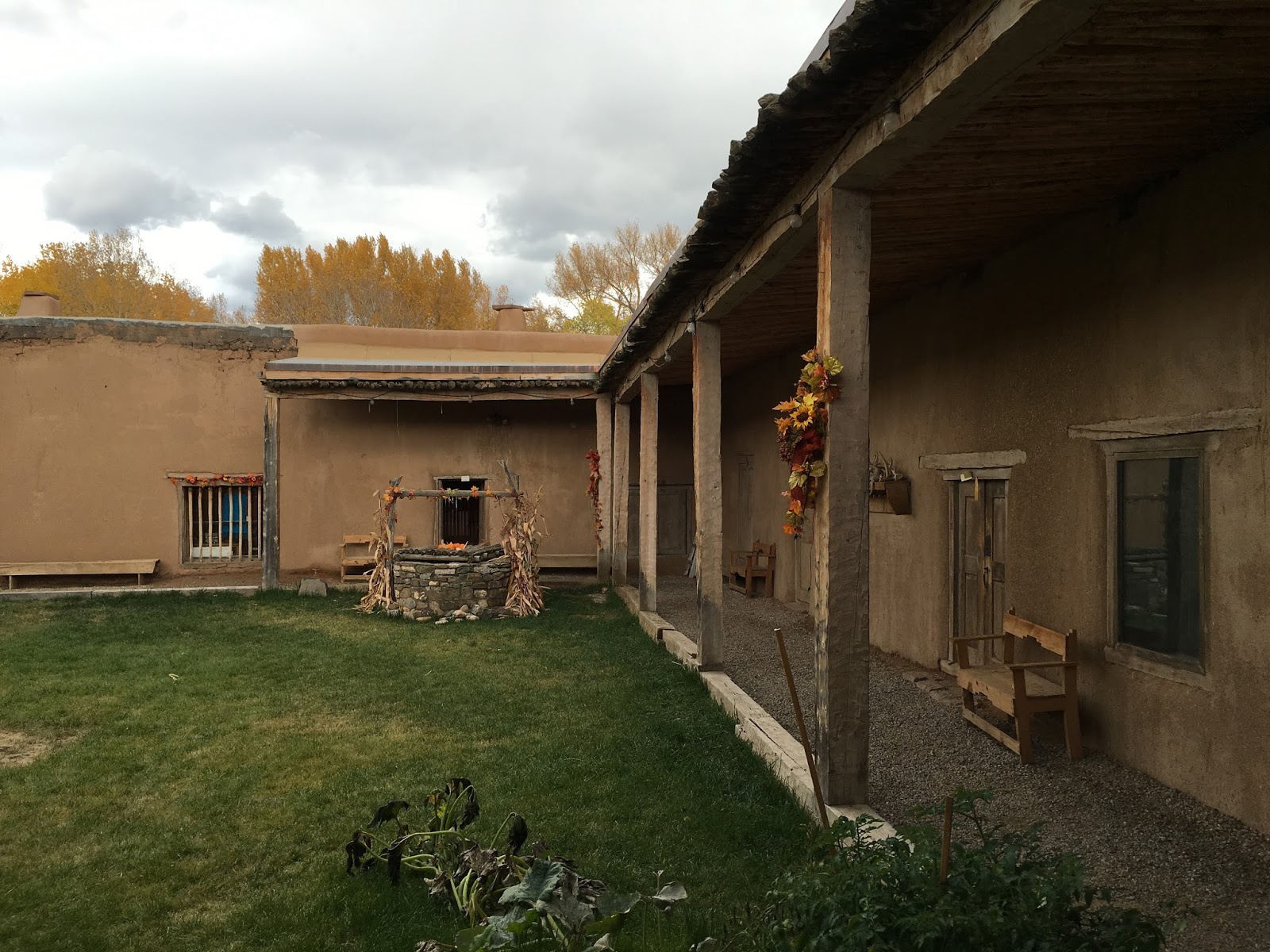 |
| Hacienda de los Martinez |
 About an hour north of Scottsbluff, NE is the Agate Fossil Beds National Monument. This monument protects the sight of a rare deposit of fossils. This deposit consists of mammals that date to about 19-20 million years ago. It is believed that the large number of animals died of malnutrition at the site of a water hole during an extended drought. The exhibits at the visitor center are minimal as all of the bones taken are held at various museums around the world. There are a few exhibits made from casts.
 There is a one mile trail that we walked to see fossilized burrows, call Daemonelix (pronounced dee-mon-ee-licks), of prehistoric animals that are believed to have been much like today's Prairie Dogs. The Daemonelix are spiral, or cork screw, shaped. Settlers called them "Devil's corkscrews".
 |
| Daemonelix sign |
 |
| Daemonelix protected by case |
 |
| Great Lakes exhibit |
 |
| Canoe Cups that a voyageur would clip to his belt. He could dip into the stream for a drink during long stints of paddling. |
 |
| The broken rifle was found in the Black Hills along with the skeletons of a man and a bear |
 |
| 39 ft Birch Bark Canoe like those used by fur traders |
 |
| Far left: one of 90 guns surrendered in 1877 by Sioux and Cheyenne warriors. Next one to the right was captured from the Cheyennes in January 1879. Standing on far right is a Sharps captured at Wounded Knee in 1890. The pistol is a Colt Peacemaker captured at Wounded Knee by a newspaper correspondent that was there. |
 |
| Reconstructed Bordeaux Trading Post |
 |
| Trading Post interpretive sign |
 |
| Horsethief Trail |
 |
| George (Mt Rushmore) from the side |
 |
| Sheridan Lake from Flume Trail |
 |
| Flume Trail - old retaining wall for Flume bed |
 |
| Flume Trail |
 |
| First tunnel on Flume Trail |
 |
| Bottle brush stalactite |
 |
| Cave Bacon |
 |
| South Unit view |
 |
| South Unit - Little Missouri River flows through the park |
 |
| South Unit view from Buck Hill |
 |
| Maltese Cabin |
 |
 |
| Cannonball Concretions at North Unit |
 |
| Mother Nature's handy work. Made us think of a Cave turned inside out (North Unit) |
 |
| Bentonitic Clay Overlook at North Unit |
 |
| A view of the Little Missouri River Valley in the North Unit |
 |
| Fort Union Trading Post |
 |
| View inside Fort Union Trading Post |
 |
| Picture of the Fort when it was in its prime. Note how close the Fort is to the Missouri River. |
 |
| Picture of the Missouri River from the Fort. |
 |
| Panoramic pic of confluence. Missouri comes downstream from right, Yellowstone coming downstream from the top and the Missouri continues downstream to the left. |